
This year, location-based AR experiences are transforming how users interact, engage, and discover content. Adding digital attributes to physical places has become even more natural and intuitive for everyday users to uncover new experiences. It is also becoming more seamless and authentic for developers and creators to streamline building and publishing these experiences.
From creating an Android Virtual Guide at CES to augment helpfulness for how attendees experience in-person events, to bringing Paper Tree’s origami from San Francisco’s Japantown into the digital age to create exciting storefront experiences, our tools empower developers and creators to create effortlessly, enhancing user interactions.
Last year, we launched Geospatial Creator1 , powered by ARCore and Photorealistic 3D Tiles from Google Maps Platform, in Adobe Aero and Unity. Developers and creators have been able to build world-anchored, immersive experiences in minutes with little to no coding abilities required. Since then, over 2,700+ participants from Google’s Immersive Geospatial Challenge have used Geospatial Creator to create robust AR experiences for a number of use cases, including entertainment, events, local discovery, travel, and commerce.
In the past year, we’ve consistently heard from you that while content creation is now easier than ever, ensuring your content reaches the right audience can be difficult. Therefore, we have been exploring new ways to connect your Geospatial AR creations with more users.
Today, we’re excited to announce a pilot program that showcases incredible AR content from select partners, within Google Maps, which more than one billion people worldwide use to navigate and explore. Geospatial AR content will be visible from your mobile device using Street View and Lens in Maps.
Users can discover the AR content by simply searching for a location in Google Maps. If the selected point of interest has AR content and the user is near the place, all they need to do is tap on the image that says “AR Experience” and lift their phone, just like they would with Lens in Maps. If they’re exploring a place remotely, they will be able to see the same AR experience in Street View - making it a seamless and accessible experience regardless of their location. Lastly, users can amplify and share the experience through a deep link URL or QR code on social media.
Our Early Access Program will begin in Singapore and Paris later this year as a 6-month pilot. To give you an idea of how these experiences come to life, we’ve been working with the Singapore Tourism Board and Google Arts & Culture to build real-world use cases that showcase how partners can reach the broadest and most relevant audiences.
Singapore Tourism Board and its local tourism partners have expanded beyond the AR experiences available in Merli’s Immersive Adventure with new immersive points of interest throughout key tourism precincts in the city. Embark on an exciting journey across popular landmarks, such as Singapore’s Chinatown and Gardens by the Bay. Whether you want to watch the ceremonial dragon dance or view the local dishes you can try at the Maxwell Food Centre, there is a wide range of AR experiences that anyone visiting Singapore or around the world can discover and enjoy through Google Maps.
Link to Youtube Video (visible only when JS is disabled)
In partnership with Google Arts & Culture and Rock Paper Reality, we visit Paris to help people take a step back in time. See the scene of the 1900 Exposition Universelle country pavilions along the Seine River and visualize the unrealized modifications to the Eiffel Tower. With Geospatial AR content in Google Maps, everyone can learn more about these moments in time in an immersive and engaging way, and then delve deeper into the story on Google Arts & Culture. Stay tuned for later this summer when we reveal the full cultural and historical story!
Link to Youtube Video (visible only when JS is disabled)
We are committed to making your AR content creation experience even better. That’s why we’ve been rolling out a number of updates to improve content creation performance and efficiency with Geospatial Creator.
First, we are excited to announce that Geospatial Creator in Adobe Aero is now available to everyone. This means, no more waitlists - creators worldwide can jump in and start building world-scale AR experiences today! We have continued to enhance localization speed and anchor accuracy, ensuring your AR creation is placed with even greater precision.
Second, we released updates to Geospatial Creator earlier this year that help developers create and adjust anchors at scale within the Unity Editor using the C# programming language. This helps scale out immersive experiences to multiple locations. With the Places API from Google Maps Platform, developers are now able to create content once and anchor the same content at all of the desired locations at once and provide relevant place information.
Third, we are expanding ARCore Geospatial API coverage2 to include India, home to some of the most innovative creators and engaged viewers. Stay tuned for later this year to hear how we’re expanding to Android first. We can’t wait to see what you create there!
To hear the latest updates about Google AR, Geospatial Creator, and more follow us on LinkedIn (@GoogleARVR) and X (@GoogleARVR). Plus, visit our ARCore and Geospatial Creator websites to learn how to get started building with Google’s AR technology.
1 Disclaimer: Geospatial Creator and Photorealistic 3D Tiles are available in over 2,500 cities across 49 countries.
2 Disclaimer: Geospatial API is enabled in areas covered by Street View.
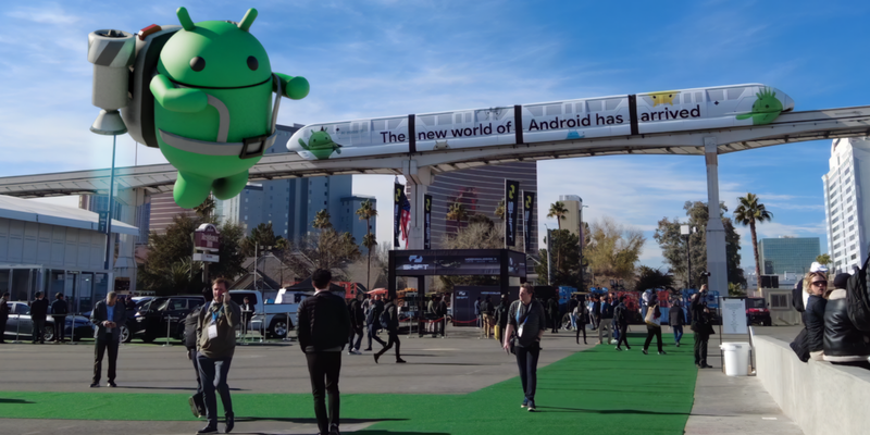
How We Made the CES 2024 AR Experience: Android Virtual Guide, powered by Geospatial Creator
Start Building with Project IDX Today

Welcome India to the Google Wallet API
Everything you need to know about Google Wallet
How Firebase Genkit helped add AI to our Compass app
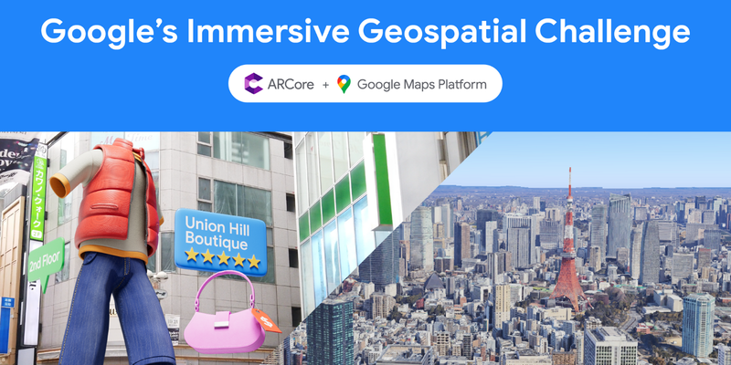
Congratulations to the winners of Google’s Immersive Geospatial Challenge